| | Published October 13th, 2010
| Tour of Downtown EBMUD Pathway
| | By Cathy Tyson |  | | Photo Cathy Tyson
|
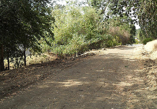
With stops from Risa Road to Brown Avenue, a field tour of the East Bay Utility District (EMBUD) Aqueduct Pathway illuminated the challenges and opportunities for this one and a half mile long, one hundred foot wide swath through the heart of downtown. Right now the rustic, weed filled path is unimproved, but it doesn't take an engineer to see that it has a lot of potential.
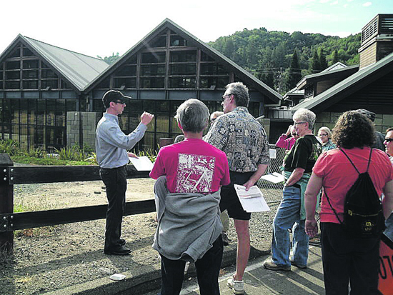
 Funded by a Caltrans grant, the City of Lafayette conducted the site tour and subsequent analysis on October 2 to determine the feasibility of a bike, stroller and pedestrian pathway with Consultant Ian Moore of Alta Planning and Design along with Leah Greenblatt, Lafayette Transportation Planner, and representatives of EBMUD.
 There is an existing use agreement with EBMUD for the right-of-way; but how the pathway might be developed, along with who will pay for it, is all undetermined at this point.
 The Aqueduct right-of-way is located between Mount Diablo Boulevard and Highway 24.
 "Residents and community leaders have seen this site as a great opportunity with significant challenges for years and now we have the resources, thanks to a Caltrans Community Planning Grant, to ask and find answers to the tough questions including how to develop public access along an aging drinking water pipeline, how to cross busy roadways, how to navigate steep grades, how to tie the pathway into the community, and ask who would maintain a pathway in this location," said Moore.
 Back in 2006 the Lafayette Bikeways Master Plan identified studying the Aqueduct as a high priority project, as part of an overall plan to improve safety and identify and prioritized bikeway needs.
 "Our job on this study is to consider all the options and demonstrate what the pros and cons are of the various options so that residents and elected officials can make an informed decision about how to proceed," Moore explained. "We'll be talking with local business owners and residents and hosting a couple of evening workshops showcasing these options in the next several months."
 Along the route of the tour, site specific design issues came up at five stops. "We heard while walking the site that folks are concerned about crossing at street level at Oak Hill Road and First Street because of traffic speed and driver inattention even if the trail crossing were to be protected with a traffic signal," said Moore.
 Many of the tour participants noted a surprising amount of underutilized space under the freeway near the final tour stop at Brown Avenue. Ideas like a possible dog park, a trail head or an opportunity for a park were suggested.
 The city has a number of stakeholders in the potential project, including EBMUD, Caltrans, East Bay Regional Park District, and BART. "Let's do technical analysis to look at all the possibilities," said Leah Greenblatt, explaining the purpose of the study at the first stop of the tour.
 A river runs under it - existing pipes that transport water are under the southern 50 feet of the aqueduct right of way. Moore said that EBMUD is sensitive about soil disruption directly above the large, aging pipes - describing design options as "constrained."
 Later this fall there will be focus groups with adjacent property owners and a public workshop. The public is invited to send comments and concerns via the www.lafayettepathway.com website. The Bikeways Master Plan, background information and the opportunity to sign up for future emails can also be found on the website. Later this fall there will be focus groups with adjacent property owners and a public workshop. The public is invited to send comments and concerns via the www.lafayettepathway.com website. The Bikeways Master Plan, background information and the opportunity to sign up for future emails can also be found on the website.

|
 | | Consultant Ian Moore addressing tour participants at the first stop
behind the Veterans Memorial Building. Photo C. Tyson
| | | | | | | | | | | Advertisement | | |
| | | | | | Comments | | | | | |  | | |
| | |  | | |
| | | | |


