|
|
|
|
Submit
|
Custom Search
CivicLifeSportsSchoolsBusinessFoodOur HomesLetters/OpinionsCalendar

Published March 3rd, 2021
Discovering dog-friendly trails during pandemic
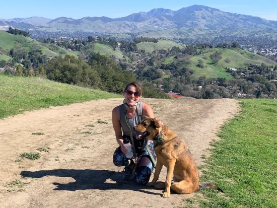
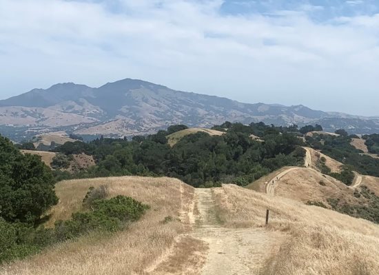
View of Mt. Diablo from Lafayette Ridge trail with Jenn and Tchoupper Photo Lisah Kmet

Exploring the great outdoors has been one of this past year's silver linings. Another bright side for many families has been the addition of a "COVID dog" because ... why not now? Together, a new (or old) furry friend and the glorious Lamorinda hills make a winning combination for endless expeditions right in our backyard.
While popular paved trails like the Lafayette Reservoir and the Lafayette-Moraga Trail are convenient options, they are heavily-trafficked and can be a bit distracting, especially for puppies. Plus, exploring a road less traveled often brings the reward of breathtaking views.
After nine months of exploring miles per day, my COVID dog, Tchoupper, and I have discovered some pretty epic dog-friendly Lamorinda trails.
All of these trails can be accessed on the All Trails app as well, which provides directions, trail details, a GPS tracking map, and more helpful tools. Happy hiking!
Mulholland Ridge:
Distance: 2+ mile out and back, depending on where you turn around
Dog rules: allowed off leash on the paved part of the Moraga side (south of the water tower)
Level: fairly easy with one decent hill on the Moraga side
Access: trail can be accessed on both sides via Donald Drive
More info: managed by the town of Moraga; https://www.moraga.ca.us/439/Mulholland-Ridge-Open-Space-Preserve

Lafayette Ridge Trail:
Distance: up to 6.6 miles out and back, depending on where you turn around
Dog rules: allowed off leash as long as 200+ feet from entrance
Level: generally moderate, with a few more difficult hills on the far end of the ridge
Access: Lafayette Ridge Staging Area on Pleasant Hill Road
More info: managed by East Bay Regional Park District; https://www.ebparks.org/parks/briones/

Springhill to Buckeye Ranch Loop:
Distance: 2.2 loop
Dog rules: allowed off leash as long as 200+ feet from entrance
Level: moderate to difficult with a steep incline and some loose dirt on parts
Access: Springhill Staging Area
More info: managed by East Bay Regional Park District; https://www.ebparks.org/parks/briones/

Reservoir Rim Trail:
Distance: approx. 5 mile loop
Dog rules: on leash only
Level: moderate to difficult with one especially steep hill in Moraga
Access: main entrance at Lafayette Reservoir parking lot; various other neighborhood entrances
More info: managed by East Bay Municipal Utility District; https://www.ebmud.com/recreation/east-bay/lafayette-reservoir/

King Canyon Loop:
Distance: 6.4 mile loop from staging area
Dog rules: on leash only
Level: moderate (with one killer hill about mile 5)
Access: Valle Vista Staging Area on Canyon Road via Rocky Ridge Trail
More info: managed by East Bay Municipal Utility District; https://www.ebmud.com/recreation/east-bay/east-bay-trails/

Blue Oak Trail:
Distance: 3.3 mile loop
Dog rules: allowed off leash as long as 200+ feet from entrance
Level: moderate with a few steep hills
Access: Reliez Valley Staging Area
More info: managed by East Bay Regional Park District; https://www.ebparks.org/parks/briones/

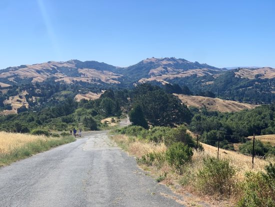
View of Moraga hills on Mulholland Ridge Mulholland Ridge: This wide, mostly paved ridgeline trail from Moraga to Orinda offers unobstructed views of the Moraga hills as well as Mt. Diablo. Photo Jenn Freedman
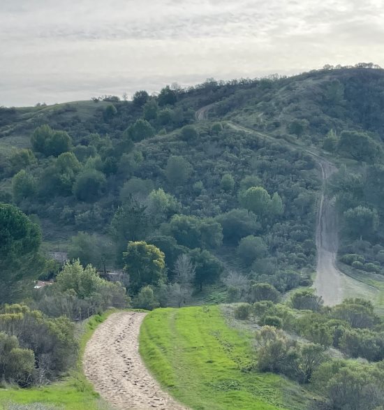
Recent view from the Lafayette Ridge trail Lafayette Ridge Trail: Part of Briones Regional Park, this scenic trail begins above Acalanes High School and follows the ridgeline for about 3 miles up and down, intersecting with dozens of other trails along the way. Enjoy sweeping views at every angle with vibrant rolling green hills this time of year (without much shade). Photo Jenn Freedman
Lafayette Reservoir Rim Trail: A moderate to difficult trail with expansive views. Photo Colleen Brown
View of the many hills on Lafayette Ridge from the Springhill to Buckeye Ranch Loop Springhill to Buckeye Ranch Loop: Also part of Briones Regional Park, the steep incline of this trail (if you start on the left side at trailhead) pays off with breathtaking views at the top where the loop meets Lafayette Ridge. Photo Jenn Freedman
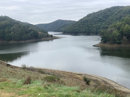
View from King Canyon Loop King Canyon Loop: A hike around this tranquil Moraga trail boasts picturesque views of the San Leandro Reservoir, aquatic birds, and other wildlife. Photo Jenn Freedman
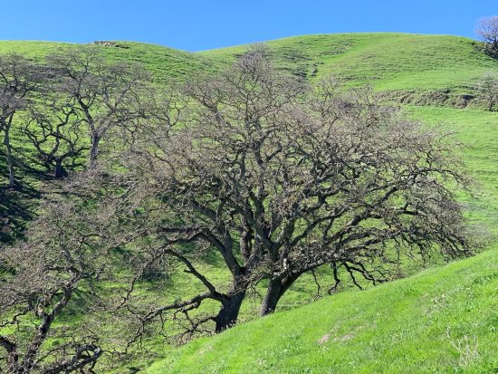
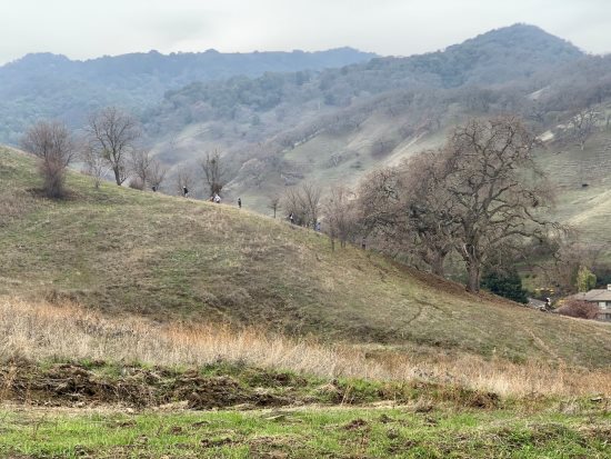
View from Blue Oak Trail
Blue Oak Trail: Also part of Briones Regional Park, this Lafayette loop features vast rolling hills. Watch out for grazing cows and mountain bikers!
Photo Jenn Freedman

print story

Before you print this article, please remember that it will remain in our archive for you to visit anytime.
download pdf
(use the pdf document for best printing results!)
Comments
Send your comment to:
Reach the reporter at:

This article was published on Page A1 / A10:


Quick Links for LamorindaWeekly.com
Home
Archive
Advertise
send artwork to:
ads@lamorindaweekly.com
Classified ads
Lamorinda Service Directory
About us and How to Contact us
Submit
Letter to the Editor
Send stories or ideas to:
storydesk@lamorindaweekly.com
Send sports stories and photos to:
sportsdesk@lamorindaweekly.com
Subscribe to receive a delivered or mailed copy
Subscribe to receive storylinks by email
Content
Civic
Lafayette
Moraga
Orinda
MOFD
Life
Sports
Schools
Business
Food
Our Homes
Letters/Opinions
Calendar
Copyright Lamorinda Weekly, Moraga CA